
West Hartford street maps from the library’s collection of local atlases have been digitized and reproduced through a generous gift from the Friends of the West Hartford Public Library.
The reproduction plates are available in the Local History Room at the Main Library. For information on how to visit our Local History Room, click HERE.
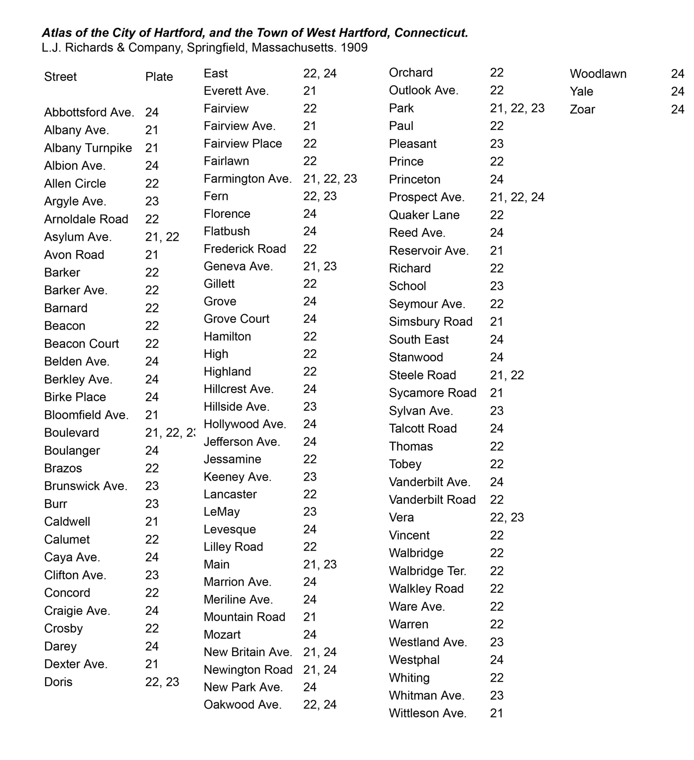
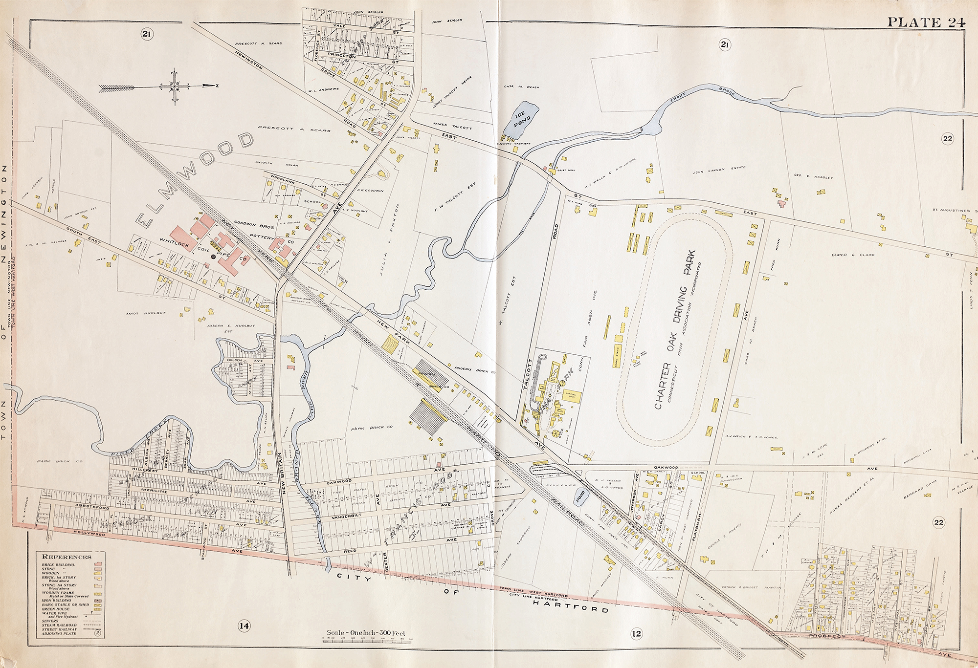
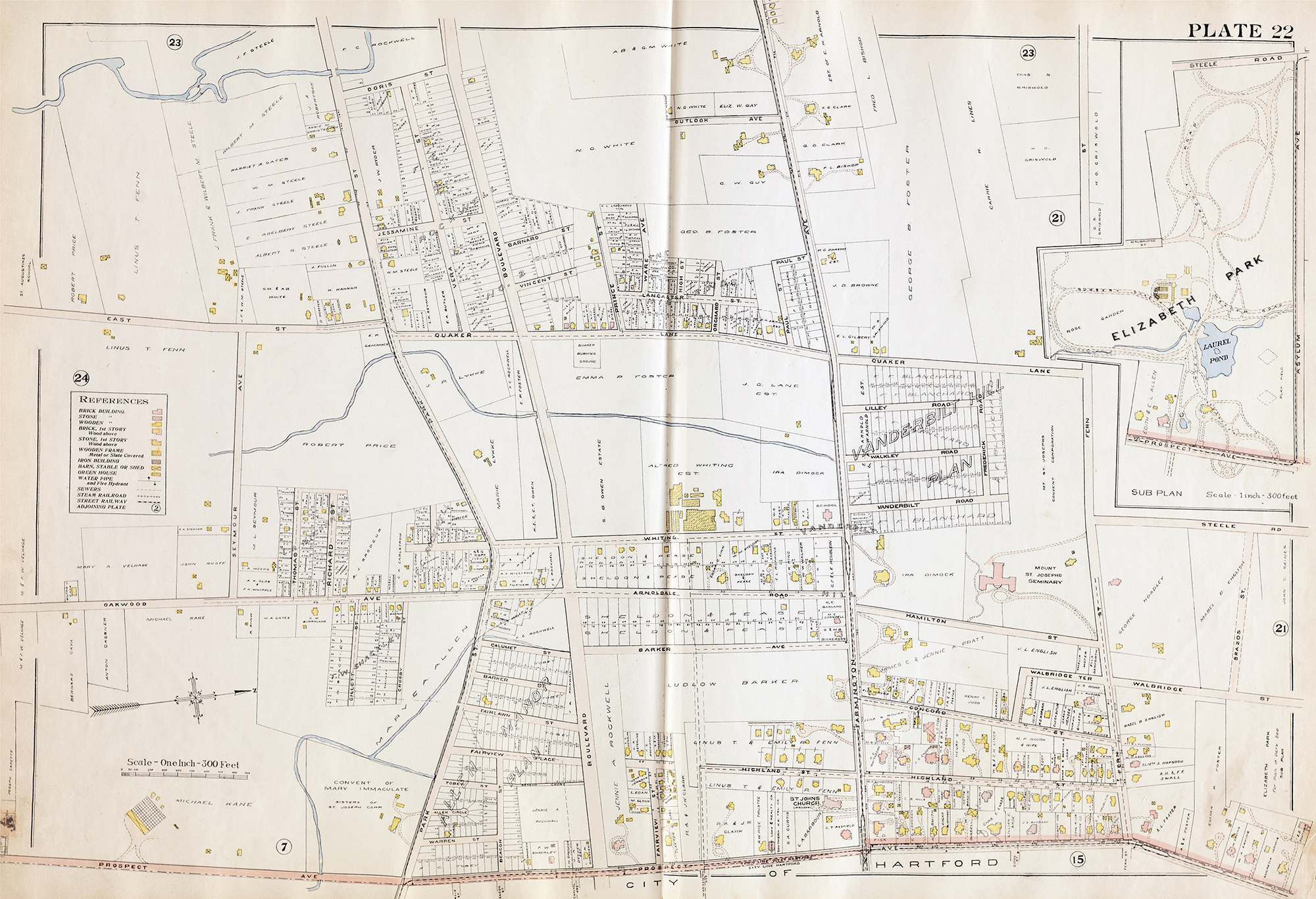
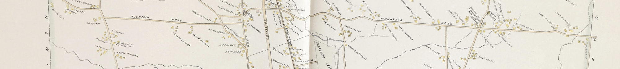
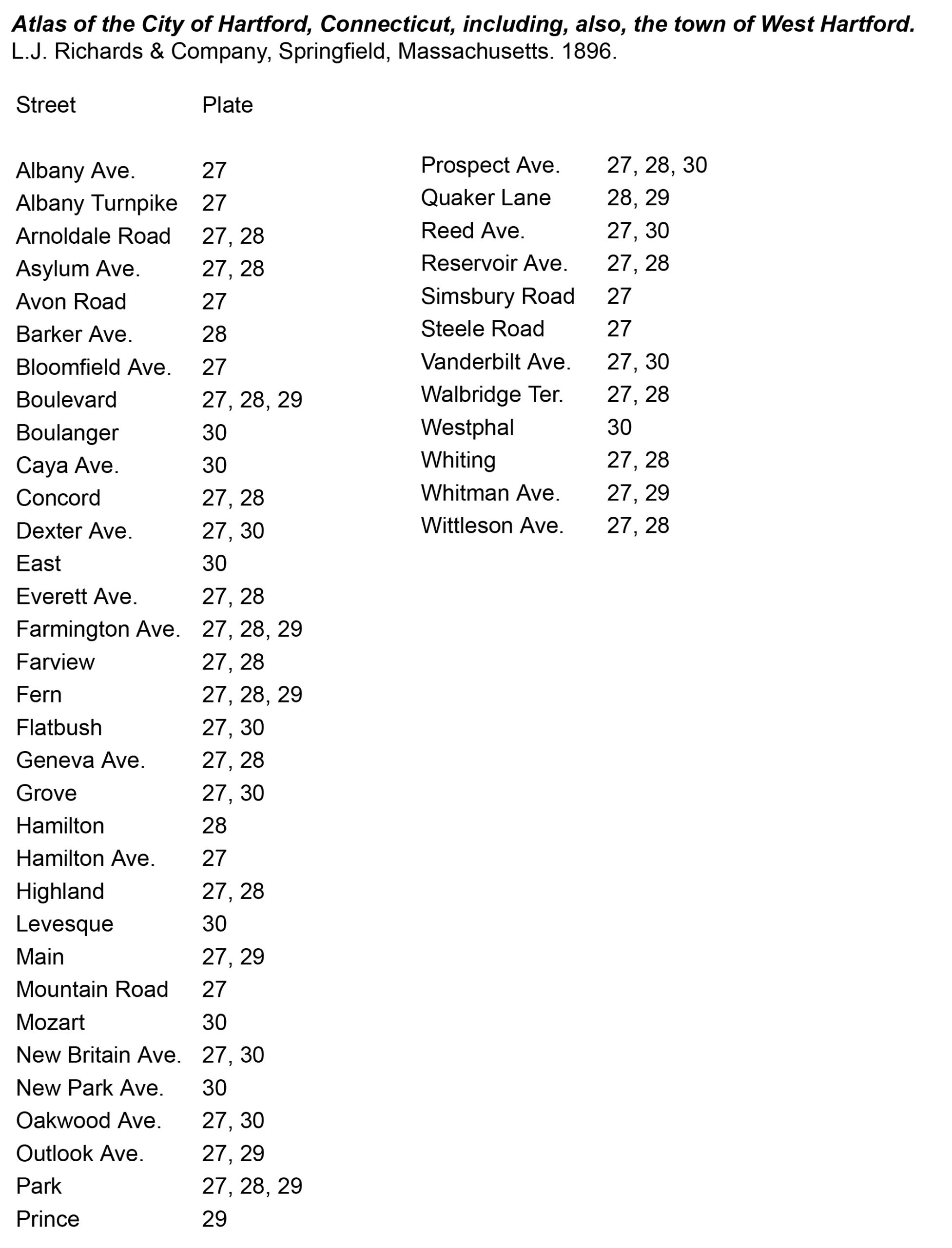
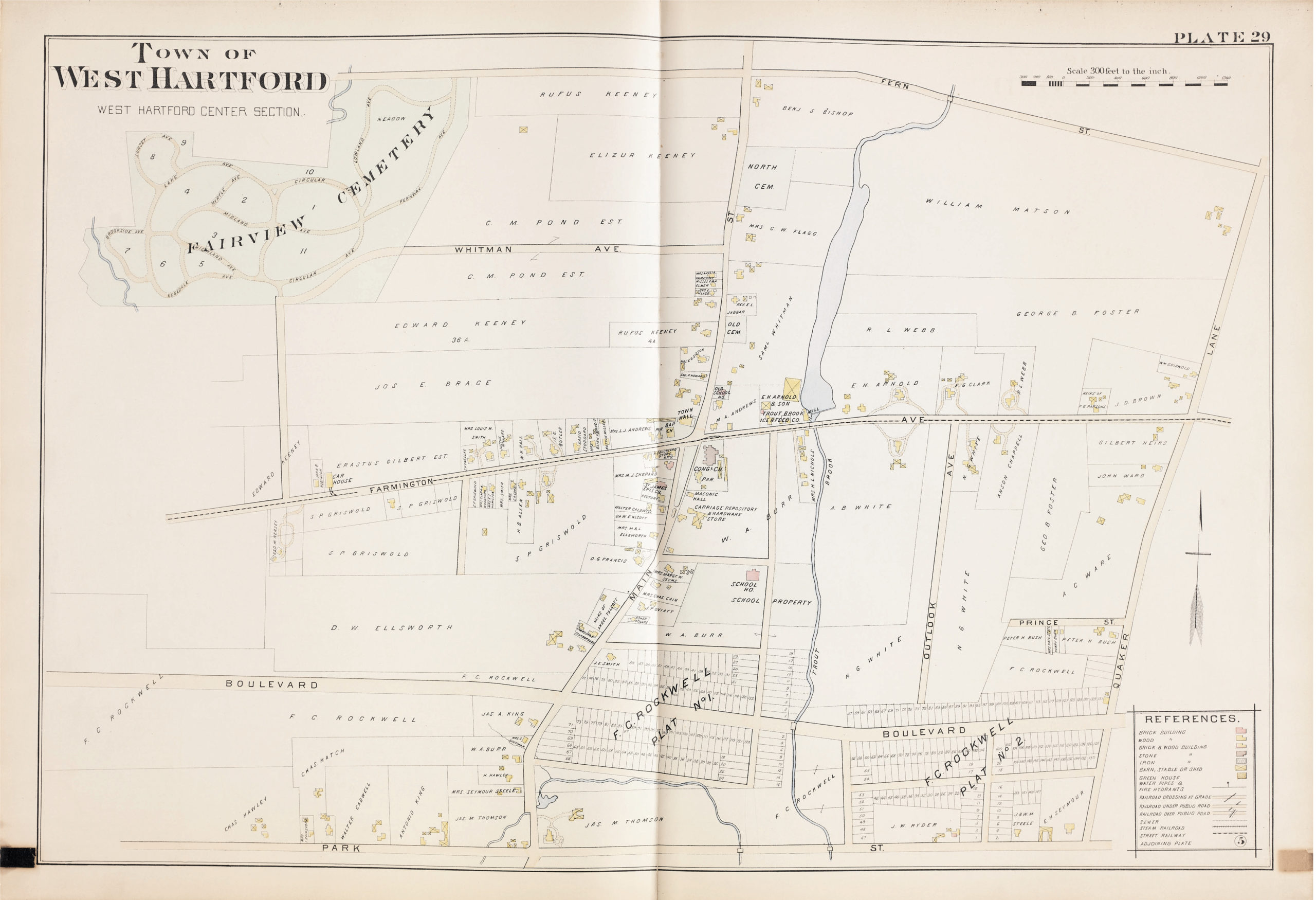
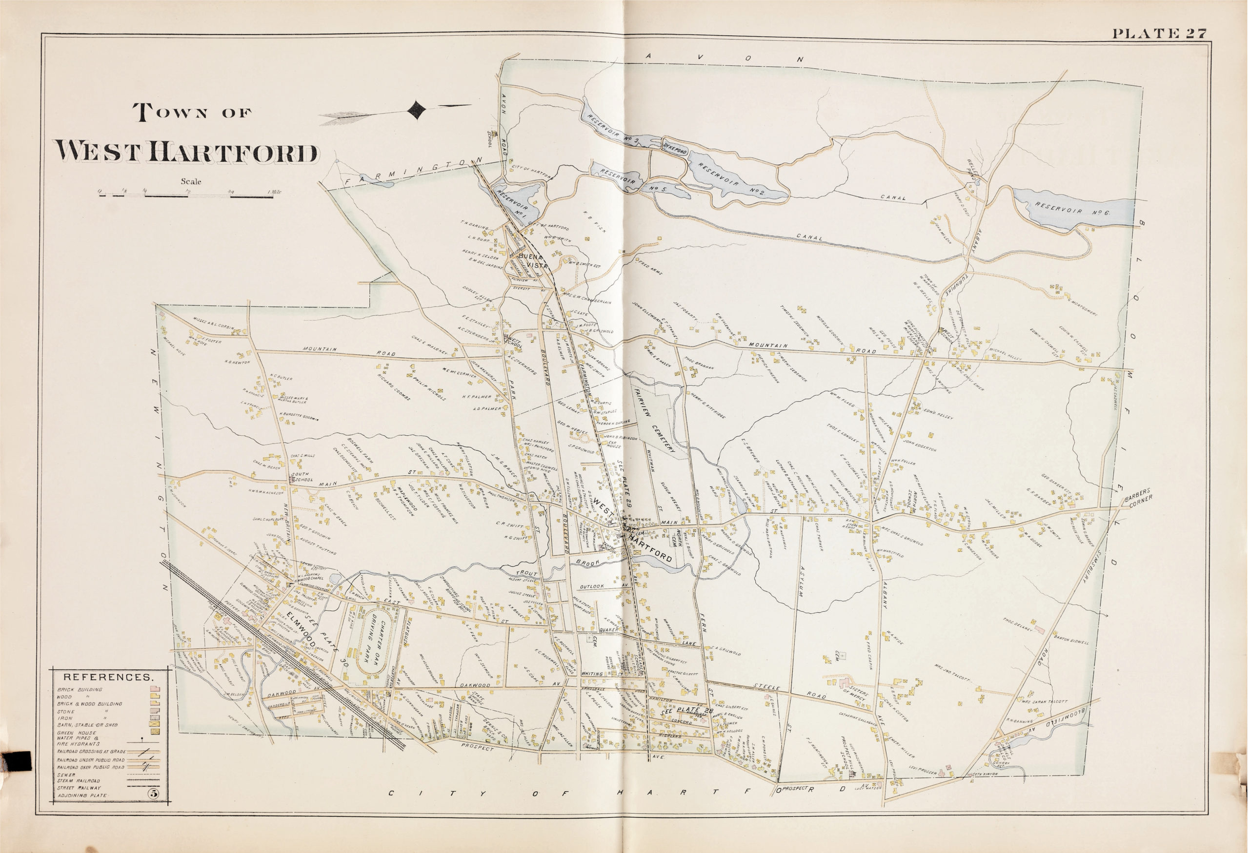
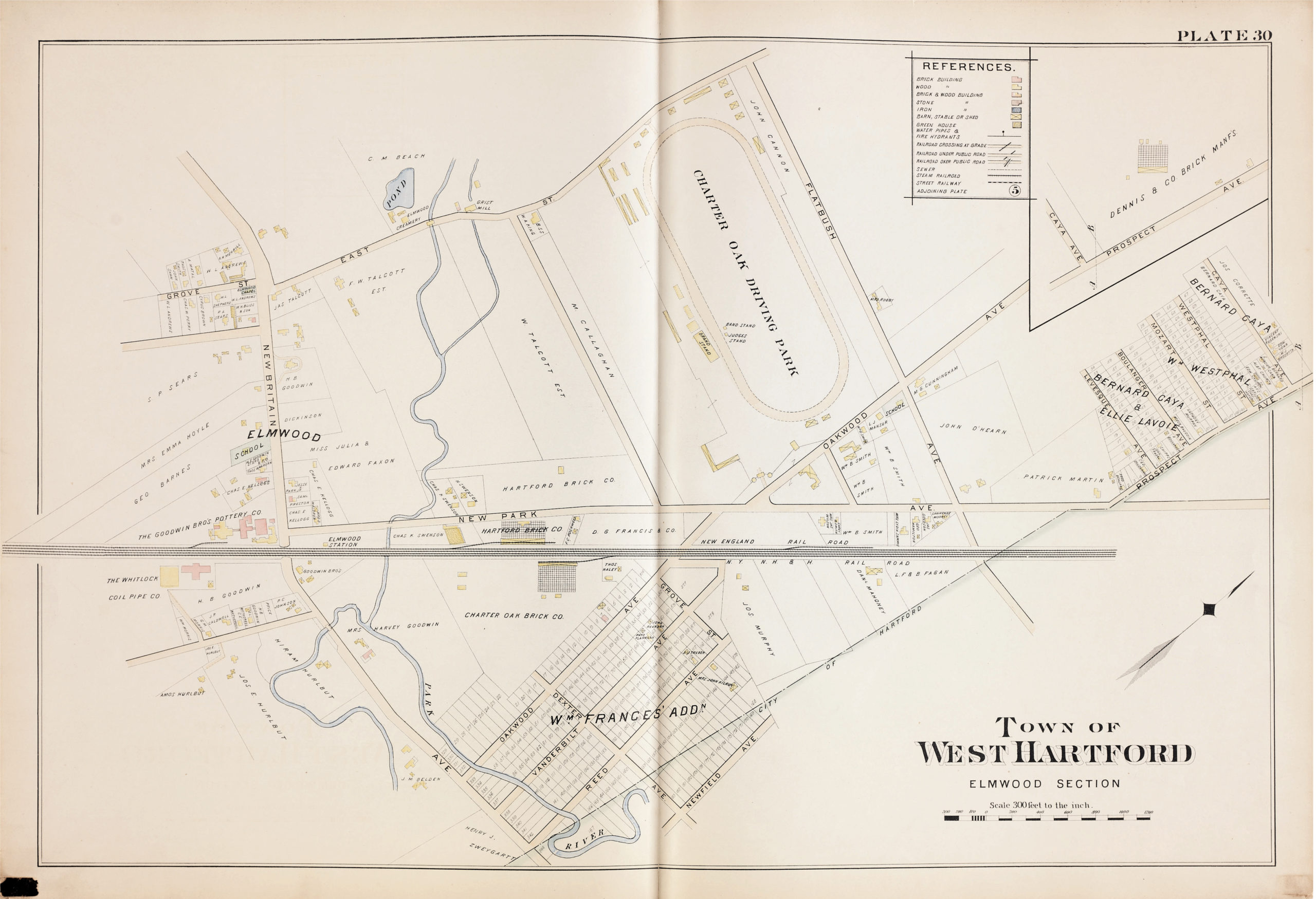
The plates showing West Hartford streets from atlases published by the L.J. Richards & Company in 1896 and 1909 are available in JPEG and PDF files below. Please note that street names and spellings may have changed.
Atlas of the City of Hartford, Connecticut
(including town of West Hartford)
L .J. Richards & Company, Springfield, Massachusetts. 1896

Atlas of the City of Hartford, and the Town of West Hartford, Connecticut
L.J. Richards & Company, Springfield, Massachusetts. 1909